Topographical Survey & G.I.S Mapping

About

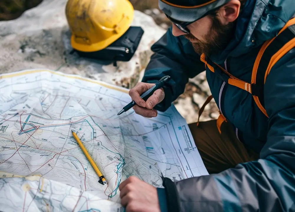
Survey is pre-requisite for development of any infrastructure project and its accuracy will provide the better platform for good engineering design.

Our Firm has significant skill in Topographical and Hydro-Graphical Survey. Our team have carried out survey in almost the length and breadth of India with state-of-the-art technology. We have also carried out survey using LiDAR technology in various terrain conditions.

Our scope of work for survey encompassed diverse variety of projects from Land Sub-Division and Mining Exploration, Major Construction, Linear Projects Surveying for Existing/New Roads/Railways, Forest Area Demarcation etc. We have the specialists in survey for Data Transfer, Processing and Interpretation. We have also the skill for carrying out Cadastral Survey for Land Assessment, Precise Engineering Survey, Site Scanning and 3D visualisation of Detailed Modelling. We keep ourselves abreast with new technology in survey and train our personnel to remain updated to the technology.

Capabilities

Subhadra Consultant has developed an identity for accurate survey and has set benchmarks in survey and geospatial solutions. We have been successful in designing and implementing cost effective solutions due to our expertise in survey. We assist the client in locating the reference pillars, control points and for final location survey or centre line marking.

We have the team of experts working on Digitisation of Maps, Assessing Land requirement for projects and preparing land schedule. We also carry out precise Engineering Survey, Site Scanning and 3D visualisation of Detailed Modelling and Flood Simulations for any area.

Key Projects

  • Name of Work – Preparation of Detailed Survey Report of Existing water Pipe Line Network of Barbil Town.
  • Client Name – WATCO Division – I, Bhubaneswar.

  • Name of Work – Preparation of Detailed Survey Report of Existing water Pipe Line Network of Keonjhar Municipality.
  • Client Name – WATCO Division – I, Bhubaneswar.

  • Name of Work – Consultancy Services for Topographical, Traffic, Geological/Geotechnical Survey and Data Collection for widening and up-gradation of National Highways to 2 lane with paved shoulder in the North East Region (NER) of India
  • Client Name – NHIDCL, Delhi

  • Name of work – Topographical Survey for Ramdaspur Project
  • Client Name – Page Industries Limited.

    Name of work – DSPS Survey of Forest Land of 44.64 Ha and M.L. Boundary for Additional land involved in Bharatpur OC Expn 26.00 MTY along with Grouting of RCC Pillar.

  • Client Name – MCL, Bharatpur Area


  • Name of work – Topographical Survey & Tree enumeration job for proposed tailing dam for Essar Steel India Limited, Beneficiation Plant, Dabuna.
  • Client Name – Essar Steel India Limited.


  • Name of work – Conducting Total Station Survey at proposed locations under CITIIS Programme
  • Client Name – Bhubaneswar Smart City Limited.


  • Name of work – Preparation for Site Plan of Parabodhi pond at Dhauli in the District of Khordha
  • Client Name – Odisha Tourism Development Corporation LTD.

  • Name of work – DGPS Survey of 20.05 acres of Forest land
  • Client Name – Emami Cement limited.


  • Name of work – DGPS Survey of RD Road to Amdarah
  • Client Name – Executive Engineer, RW Division Jharsuguda

  • Name of work – DGPS Survey for Forest Diversion Proposal of RD Road to Amdarah

  • Client Name – Executive Engineer, RW Division Jharsuguda

  • Name of work – DGPS Survey for Forest Diversion Proposal of RD Road (Nine Proposal) coming under Sundargarh RW Division
  • Client Name – Executive Engineer, RW Division Sundargarh

  • Name of work – DGPS Survey and obtaining local points for Forest road Diversion Proposal of Road Haladipani to Budham under PMGSY Package No OR-30-110/VIII in the District of Sundargarh.
  • Client Name – Executive Engineer, RW Division Sundargarh

  • Name of work – DGPS Survey of all mines of Jamul Cement work at ACC Ltd.
  • Client Name – ACC Limited


  • Name of work – Geographical coordination like latitude, longitude with digital photograph of all spot source in 8 Block under Kadhamal District.
  • Client Name – Executive Engineer, RWS&S Division Phulbani


  • Name of work – Geographical coordination like latitude, longitude with digital photograph of all spot source in 8 Block under Kadhamal District.
  • Client Name – Executive Engineer, RWS&S Division Phulbani

  • Name of work – Geographical coordination like latitude, longitude with digital photograph of all drinking water source in Korei Block under Jajpur District.
  • Client Name – Executive Engineer, RWS&S Division Jajpur at Chandikhol

Key Projects

  • Name of work – Geographical coordination like latitude, longitude with digital photograph of all drinking water source in Danagadi Block under Jajpur District.
  • Client Name – Executive Engineer, RWS&S Division Jajpur at Chandikhol

  • Name of work – DGPS /Total Station Survey in Barunmuti, Burudih, Thurkubera (Block -I) and Bahutiya Block (Block-II) Emerald (Gem Stone) area in East Singhbhum District of Jharkhand
  • Client Name – Government of Jharkhand Department of Industry, Mines & Geology Directorate of Geology

  • Name of work – Carrying out Topographical Survey of Kaiga 5&6 plant site area including cross section / L Section of streams / nullahs / rivulets and providing contour maps and drawings.
  • Client Name – Nuclear Power Corporation of India Limited

  • Name of work – Survey work with ETS for approach Road connecting MGM mineral at Meramundali in NH-55.
  • Client Name – MGM Minerals Limited

  • Name of work – DGPS Survey of Forest land for Construction of MI Projects
  • Client Name – Executive Engineer, Minor Irrigation 


  • Name of work – Regarding furnishing location and co- ordinate in respect of village Kamalpur for Badjharan MIP in Naktideul Block of Sambalpur District
  • Client Name – Executive Engineer Minor Irrigation Division, Sambalpur     
        
  • Name of work – DGPS/ETS Survey for Karlapat Bauxite Mines in Kalahandi District.
  • Client Name – OMC Ltd. 

  • Name of work – Topographic Survey of Quarry-D dump of South Kaliapani Chromite Mines over an area of 84.66 Ha (Approx.) in Jajpur District.
  • Client Name – OMC Ltd.

  • Name of work – Land Survey and Establishing reference grids bench marks pillars for 1×120 mw coal based TPP at Sri Ramchandrapur Village, Chatrapur Mandal in Ganjam District, Odisha.
  • Client Name – Dr Ramakrishna Prasad Power Private Limited 
  • Name of work – Topographical survey of Proposed Red Mud Pond-II site at NALCO Damanjodi.
  • Client Name – NALCO, Damanjodi 

  • Name of work – Topographical survey of SIPCL at Titilagarh Site.
  • Client Name– Sahara India Power Corporation Limited.


  • Name of work – Topographical Survey at Bhushan Steel Ltd.
  • Client Name–Bhushan Steel Ltd.

  • Name of Work –Topographical Survey of land measuring approximately 15 acres and geo- technical soil investigation of 6 Bore holes location at plot no. 329/2021,332/1803(part), 332/1882, 332/1950 Khata no.619, G.A Department in unit no.41, Nanandkakan Road, Chandrashekherpur, Bhubaneswar.


  • Name of Work – Topographical Survey of land measuring approximately 15 acres and geo- technical soil investigation of 6 Bore holes location at plot no. 329/2021,332/1803(part), 332/1882, 332/1950 khata no.619, G.A Department in unit no.41, Nanandkakan Road, Chandrasekharpur, Bhubaneswar.
  • Client – Suresh Goel & Associates
  • Name of Work– DGPS Survey of forest land proposed for the forest diversion Hitrai of Badjharan MIP under M. I. Sub-Division, Rairakhol in the district of Sambalpur under Incomplete State Plan 2019-20.
  • Client – Office of the Executive Engineer, Minor Irrigation Division, Sambalpur.

  • Name of Work– DGPS Survey of forest land proposed for forest diversion Kamalpur II Badjharan MIP under M.I. Sub Division, Rairakhol in the district of Sambalpur under Incomplete state plan 2019-20.
  • Client – Office of the Executive Engineer, Minor Irrigation Division, Sambalpur.

  • Name of Work– “DGPS Survey of forest land of 44.64 Ha and M.L Boundary for additional land involved in the Bharatpur OC Expn. 26.00 MTY along with grouting of RCC pillars. (RE tender).”
  • Client – Office of the General Manager Bharatpur area, MCL.

About

Our Firm has full-fledged N.A.B.L. Material and Soil laboratory for all types of Material Testing, Soil, Rock, Cement and Concrete, Non-Destructive Testing, Load Testing, Pavement Investigations, etc.

Get In Touch

© 2024 Subhadra Consultant | All Rights Reserved
Designed and Maintained by Digital Ratha